Time: 1:44
Distance: 10.39 miles
Effort: Moderate
Body: Average
Weather: Clear and Warm
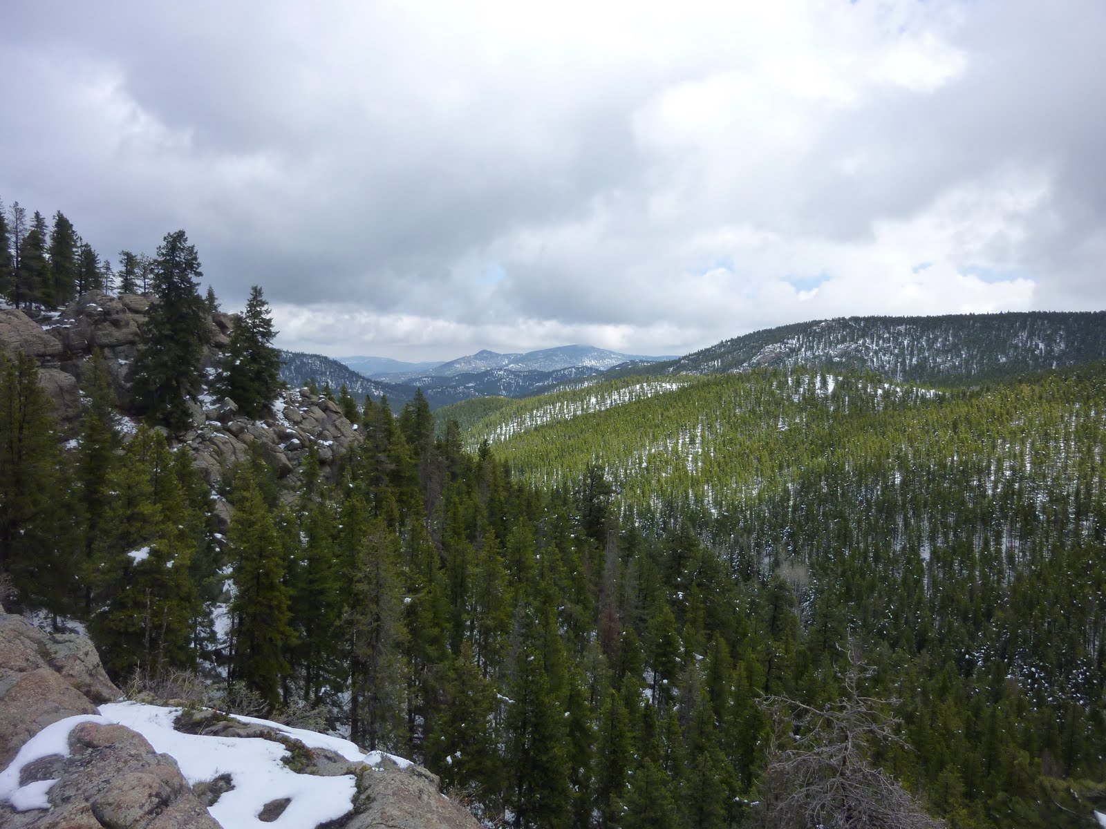
Mid-afternoon birthday run up to summit of Bergen Peak from home via frontside roads then Painters Pause, Founders and Too Long Trails. Steady, but not pushing it hard. Lots of people out on this beautiful Memorial Day. HIt the summit in 1:01.
Pushed the descent in order to get to a massage appointment JP made for me. Got home...dashed in the door...jumped in the shower...and ran out the door (with a peanut butter sandwich and bottle of water courtesy of JP) to speed to the massage appointment. Then, spent an hour and a half getting a week's worth of hard training worked out of the muscles by Tess of Treetop Thai Massage in downtown Evergreen. She's great. Highly recommended.
My first massage since July 2008. Made me wonder why I don't get massages more often. Must make a post-Lake City appointment...
Great capstone to a fabulous Memorial Day Weekend of running.
Monday, May 31, 2010
Sunday, May 30, 2010
Mt. Falcon - Recovery (?) Run
Time: 1:35
Distance: 10.26 miles
Effort: Moderate
Body: Fair
Weather: Clear and Cool
For the last month or two, Todd G. and I have been exchanging e-mails trying to figure out a time when work, family and life schedules would allow us to connect for a run. Finally, this morning the stars (and schedules) aligned and we met up at 6:30 a.m. at the base of Mt. Falcon.

I've been eager to run with Todd, not just to connect with a new running partner, but to pick his brain on Lake City, which he's run (and run well) twice. After a quick introduction at the trailhead, we set off up the Turkey Trot Trail with Todd setting a solid pace. My legs were feeling yesterday's 24 miles and 7,600-feet of elevation gain, but things got better after the initial steep sections were behind us.
As we ran, I tossed out a few questions between gasps, Todd shared his running experience and somehow we made good time up the frontside of Mt. Falcon via Turkey Trot and the Castle Trail (hitting the picnic shelter in 34:27) and continuing on to the upper intersection with the Parmalee Trail. We descended down Parmalee and looped back up to its lower junction with the the Castle Trail.

I had limited time this morning, so we returned down the way we came, keeping up a running dialog the whole way. As I headed for the car, Todd headed back up Turkey Trot for another ascent up the front side of the hill, no doubt getting in a few miles preparing to defend his title next weekend at the Golden Gate Dirty Thirty 50K.

Distance: 10.26 miles
Effort: Moderate
Body: Fair
Weather: Clear and Cool
For the last month or two, Todd G. and I have been exchanging e-mails trying to figure out a time when work, family and life schedules would allow us to connect for a run. Finally, this morning the stars (and schedules) aligned and we met up at 6:30 a.m. at the base of Mt. Falcon.

I've been eager to run with Todd, not just to connect with a new running partner, but to pick his brain on Lake City, which he's run (and run well) twice. After a quick introduction at the trailhead, we set off up the Turkey Trot Trail with Todd setting a solid pace. My legs were feeling yesterday's 24 miles and 7,600-feet of elevation gain, but things got better after the initial steep sections were behind us.
As we ran, I tossed out a few questions between gasps, Todd shared his running experience and somehow we made good time up the frontside of Mt. Falcon via Turkey Trot and the Castle Trail (hitting the picnic shelter in 34:27) and continuing on to the upper intersection with the Parmalee Trail. We descended down Parmalee and looped back up to its lower junction with the the Castle Trail.

The front side of Mt. Falcon from near the parking lot. The Turkey Trot Trail is in the foreground.
I had limited time this morning, so we returned down the way we came, keeping up a running dialog the whole way. As I headed for the car, Todd headed back up Turkey Trot for another ascent up the front side of the hill, no doubt getting in a few miles preparing to defend his title next weekend at the Golden Gate Dirty Thirty 50K.

That's Todd in white headed back up Turkey Trot in the center-right of the pic.
It felt good running on tired legs on such a brilliant morning...blue sky, cool temps, empty parking lot and good-natured hikers and bikers sharing the trail. A perfect Sunday morning.
Total elevation gain: 2,177 feet.
Boulder Skyline Traverse - Long & Hot
Time: 5:26
Distance: 24.18 miles
Effort: Easy
Body: Average
Weather: Clear and Hot
With the San Juan Solstice 50 looming in less than three weeks and a week-and-a-half-long trip down to sea level scheduled right smack in the middle of those three weeks, I was eager for a long, hard run this weekend. The run was, indeed, hard, but was made much easier by virtue of having some excellent company to share the miles with.
Met up with Brandon bright and early at Boulder's South Mesa Trailhead near Eldorado Springs. On the menu: the Boulder Skyline Traverse, a route that begins at the edge of South Boulder Creek, then climbs to the four mountain highpoints of the rocky backdrop to the metropolis of Boulder, Colorado.
First up was the climb from the trailhead to the saddle between South Boulder and Bear Peaks.With Brandon leading and setting a steady, early-morning pace, we cruised up the Towhee Trail to Shadow Canyon and made good time up the canyon's many twists, turns and step-ups.

Brandon sets the pace up the Towhee Trail bound for Shadow Canyon
From the saddle, we hung a left and made the short climb up to the summit of South Boulder Peak. I tagged the summit 60:15. We had the place to ourselves. We paused long enough to snap a couple of pictures, suck down a gel and flail about like children trying to stay out of the flight path of what had to have been the World's Largest Bumble Bee.

Looking west from the summit of South Boulder Peak
After descending back to the saddle, we made quick work of the traverse over to the scree field just below the summit of Bear Peak and began the short climb up the shards of rock to the rocky summit of Bear Peak. A few hikers were basking in the cool morning sun as we paused to look down the spine of the Flatirons to Green Mountain and rest of the day's route.

Looking north to Green Mountain from the summit of Bear Peak

A brilliantly-executed self-timer picture on the summit of Bear Peak
The run from down from Bear and over and up to Green is my favorite section of trail on this run. It's got a little bit of everything: steep descents, easy climbs, rolling trail and a few steep grades. We rolled through this section, pausing at the small stream at the mouth of Bear Canyon to dowse ourselves and our hats in the cool water. Before we'd fully dried in the rapidly warming air, we met up with Tony K., who was out for one of his 6-7 hour fun runs. After a brief conversation, we set off and made the final climb to the four-way on the Green Mountain West Ridge Trail.
From the four-way, it's a quick climb up the rocky step-ups to the top of Green Mountain and its famed summit rock. We were warmly greeted at the summit by Kraig K. who was out picking up some elevation gain on the heels of his run last weekend at the Jemez 50, a race that by every account sounds like an unforgettable and remarkable sufferfest. Kraig mentioned he was thinking about signing up for the Leadville 100. In a valiant attempt to lure him into the race, Brandon let him know that all the cool kids were running that race, except for the ones running the Pikes Peak Ascent and/or Marathon that same weekend. Kraig reports on his blog that he signed up. Brandon's power of persuasion remains unmatched.

Self portrait on Green Mountain's summit rock

Brandon nonchalantly explains where all the cool kids will be the weekend of August 21-22
After descending back down Green's west ridge, we bid Kraig adieu and we headed down the West Ridge trail to Superflag and descended down to the Ute Trail trailhead at the turn-off to Flagstaff Mountain. We soon hit the flat top of Flagstaff Mountain and found the rock that is the mountain's highpoint. We paused here to refuel before heading off down the Flagstaff Trail bound for Halfway House.

I managed to free-climb the last four feet to the true "summit" of Flagstaff Mountain
From Halfway House just off Flagstaff Road, we cruised down the Valley View Trail. Along the way, we stopped to gaze at our northerly-most destination - Mt. Sanitas. My legs were still feeling good at this point, but Sanitas looked dauntingly far away.

The high point in the middle of the pic is Mt. Sanitas
We finished our descent, pausing at Eben G. Fine park to fill our hydration packs with amazingly cold water from the restroom sink. We soon were off, headed over Red Rocks to the base of Sanitas. We ascended the Mt. Sanitas Trail, winding our way past a couple dozen hikers. It was a busy day out there. And, by this time it was warming up quite a bit. Were it not for a decent breeze blowing from the southeast, it would have been brutal. I was feeling pretty OK on the ascent, powerhiking the steep step-ups and running the rest. Hit the summit marker in 25 minutes, after winding my way through the 20 people (and their 632 dogs) hanging out at the summit. Brandon soon joined me and after a couple of pics, we set off for the character-building return to our cars at South Mesa.


Looking east from the summit of Mt. Sanitas
From the summit, we descended down to the Sanitas Valley Trail and then followed roads up to Chautauqua where we stopped to refill our water packs before heading out on the Mesa Trail. The Mesa Trail offered some welcome shade and some moderate ups and downs.

Brandon cruising down the Mesa Trail as seen through a malfunctioning camera lens.
We made good time over to Bear Canyon where we met up with Justin M., Nick C. and Nick P. who were out practicing togetherness in preparation for racing (Nick C.), pacing (Justin) and crewing (Nick P.) at the Western States 100 later this summer. After another four miles, we wrapped up the Mesa Trail return with a quick descent down to the cars.
The run today came up about three miles shorter than the last time I did this run, the last five miles of which I did in the dark sans a light. I realized today that I missed two Mesa Trail turns last time, one of which I realized and corrected and another than took me an extra mile or two toward the east.
Once back at the cars, we both had food and drink on our mind. So, we caught our breath, reflected briefly on a great, hard run and took off. I went straight to the gas station at the turn-off to the road to Eldorado Springs and loaded up on a protein drink and a quart o' Gatorade before making the 40 minute drive back home.
All-in-all, it was a great day. We worked steady on the ups, ran the flats at a reasonable pace and picked up just a bit shy of 8,000 feet of elevation gain. Really enjoyed spending the hours with Brandon and swapping thoughts on prep and strategy for Lake City.
Friday, May 28, 2010
Boulder Valley Ranch - Boulder Rez - Easy
Time: 1:15
Distance: 9.68 miles
Effort: Easy
Body: Average
Weather: Clear and Hot
Mid-afternoon figure eight loop around Boulder Valley Ranch Open Space and the Boulder Reservoir. May have to start carrying a water bottle. I'm not yet used to the heat. I was parched and running out of gas by the end of the run.
Long run planned for early tomorrow morning. South Mesa trailhead in Boulder - 6:30 a.m.
Thursday, May 27, 2010
Green Mountain (Denver) - Denver Trail Runners Group Run
Time: 1:24
Distance: 10.12 miles
Effort: Hard
Body: Average
Weather: Clear and Warm
Work and volunteer board commitments kept running off the day's agenda until the evening. I dashed out of the house at 6 p.m. and hightailed it down to Denver's Green Mountain to take part in the Denver Trail Runners group run. I pulled into the parking lot off Rooney Road right as the group of 30 or so was heading out. I quickly jumped out of the car and joined the group as it made the short climb up to the bridge over C-470.
As everyone warmed up, runners quickly sorted themselves out by pace. I joined a group of seven or so runners in the lead group and we took off down the undulating trail along the south and east sides of the mountain. We ran at a quick, but conversational pace. We soon hit the big climb on the east side and our lead group shrunk to five, then two. We regrouped at a trail junction and set off again to complete the climb to the antennae on the eastern highpoint of the mountain. About a quarter mile in on this section of trail, I had to leap over a rattlesnake taking a break half-on, half-off the trail. I love wildlife.
I soon was running alone, since I was out for a tempo effort run and several of the guys in the group were holding back in preparation for races this weekend. We regrouped again at another junction and then it was off to the (downhill) races. I've been putting some focus on working on my descending skills of late, so I used this opportunity to run hard downhill. The trail was pretty smooth and pure singletrack bliss. At the bottom of the hill, I was quickly joined by another guy (racing the Sageburner 25K this weekend) and cruised back to the parking lot.
After a brief pause, I left the growing group of returning runners and headed out across Rooney Road to the Zoro Trail to get in a couple more miles of ascent/descent. I climbed Zoro to the top of the hogback and returned the way I came. Another great run. This has been a solid week of running, despite the still-lingering illness (just hacking up junk now).
Elevation gain: 1,478 feet; Average pace: 8:19
Wednesday, May 26, 2010
Flatiron Vista - Spring Brook Loop - Steady
Time: 1:06
Distance: 8.53 miles
Effort: Moderate
Body: Average
Weather: Clear and Warm
Post-work run beginning at the Flatiron Vista Trailhead off Highway 93. Great steady run across the plateau, down Dowdy Draw and then did the Spring Brook Loop counterclockwise. Love the views of the Flatirons from the grassy vista points along the north part of the Spring Brook loop.
I had several negative interactions with mountain bikers over the course of the hour-plus run (also had some great interactions). At one point, near the bottom of Doudy Draw, I had to literally leap off the trail to avoid getting smacked by a biker whipping around a corner. As a mountain biker that loves whipping around corners and bombing downhill, I raise these problems with trepidation. It's funny, in all my running in JeffCo, I've had maybe two bad experiences with mountain bikers. In Boulder, virtually every time I run on trails where bikes are allowed (Heil Ranch, Doudy Draw), I run into jerks. Has all the exclusions from city/county trails made bikers surly and unwilling to play nice? Something in the water? (Or, maybe I'm the jerk!) Whatever it is, it makes me mad, not so much because of issues with my personal space or safety, but mostly because I know that poor behavior by a few bikers with the wrong set of hikers is going to set back mountain bike access efforts that good groups like the Boulder Mountainbike Alliance have been working on for years. Same goes for riding in muddy conditions, especially on the wide-open parts of this trail system. These trails do not drain well. Tons of rutting on some sections of this trail from riding in muddy conditions. Then, people and bikes go around the rutty, muddy sections and make trails twice as wide as they were a month before, which is what's happened on parts of this trail system. Some singletrack is now doubletrack.
Anyway...off the soapbox.
This was a great run. Everything clicked. After the Spring Brook loop, I returned up Doudy Draw to the Flatiron Vista loop, hung a right and ran to the southern edge of the property and picked up the Prairie View trail for the return to main road/trail out of the parking lot. Great day.
761 feet of elevation gain; average pace 7:46.
Tuesday, May 25, 2010
Elk Meadow - Tempo Stuff
Time: 47 minutes
Distance: 6 miles
Effort: Hard
Body: Fair
Weather: Clear and Warm
Another crazy busy day at work. Crammed in a quick run at the end of the day. Ran from home to the upper lot at Elk Meadow, then did 34 minutes of one-hard; one-easy sessions running the Meadow View - Painter's Pause - Roads back home route. Legs were a bit tired from the last two days of running up Bergen Peak and from the lingering effects of my spring crud, but still managed to hit some 5:20 pace grooves now and then..
Monday, May 24, 2010
Bergen Peak Upper Loop - Moonlight Run
Time: 1:36
Distance: 9.45 miles
Effort: Easy
Body: Fair
Weather: Clear and Cool
A jam-packed day at work today, combined with an early evening baseball practice with jP, pushed the run into the post-dinner realm. So, with the gang fed and winding down, it was time for me to get wound up by doing another run up Bergen Peak.
I headed out the door around 8:10 p.m. with a headlamp in hand and ran up to Elk Meadow Open Space's upper parking lot and hopped on the Meadow View Trail bound for the upper loop, which consists of the Bergen Peak Trail and the Too Long Trail and loops back down to the lower parking lot via Meadow View and Painter's Pause.
This was basically the same run I did yesterday, with a variation at the beginning and minus the out-and-back one-mile summit trail. And, there was one other major difference...I did over half the run, time-wise, in the dark.
I cruised up the Bergen Peak Trail at a steady pace, pausing in a couple of spots to take in the view of the still all-white Mt. Evans. I made it to the trail's high point before the darkness really set in and I had to turn on my headlamp, which I carried in my hand. Even with the moonlight providing some extra light (enough for me to cast a moon shadow a good chunk of the way down), the headlamp was a necessity. I made steady progress around the loop as I passed the turn-off for the summit trail and Bergen Peak Trail turned into Too Long.
The run down Too Long was a bit of a blur as I had to keep my focus confined to the 5-6-foot circle of light my headlamp provided. My fading batteries certainly were no help. Still, there was one moment, about half-way down, where I paused and took in the view of the moon-lit meadow below me and the distant lights of Denver flickering just over the ridges of the foothills. Gorgeous.
Once off Too Long and back on Meadow View, i made my way out of the trees and into the meadow proper. Without the trees to block the moonlight, I could now run sans the headlamp. It was a great feeling running through the night, the trail illuminated only by the light of the near-full moon.
Got home at about 20 minutes before 10 p.m., just in time for a quick shower and another few hours of work.
Still on the mend from the crud, but definitely and noticeably improving. Another day or two and I should be back to 100 percent. Finally...
Elevation gain: 1,831 feet.
Sunday, May 23, 2010
Bergen Peak - Feeling a Wee Bit Better
Time: 1:44
Distance: 10.76 miles
Effort: Easy
Body: Poor
Weather: Sunny and spring-like
After taking Saturday off again due to illness (four days off this week), I decided it was time (again) to get out despite feeling crappy. With SJS less than a month away, it's been killing me to be sidelined with the crud this week. So, off to run Bergen Peak I went.
Bergen Peak, part of Elk Meadow Open Space here in JeffCo, features a great pair of trails that lead to the one-mile summit trail. Both directions, either up the Too Long Trail, or the Bergen Peak Trail, is completely runnable with great hardpack trail with just enough rocks, switchbacks and steepness to keep a runner honest.
From home, I ran the 3/4 mile jaunt to the lower parking lot on our local roads and then began the climb up Painter's Pause to its apex and then headed west to the Meadow View Trail and on to the launching point of the Too Long Trail.
Despite feeling the lingering fatigue from my now five-day illness, I made descent time up Too Long, tagging the summit sign in 1:05 before turning-tail and heading back down. While retracing my steps down the summit trail, I encountered that rare, undignified breed of human being known as the Switchback Cutter. This particular individual came complete with a plump yellow Labrador retriever (naturally with no sign of a poop bag). After pausing long enough to offer a few helpful, and no doubt well-received, insights into the reasons why cutting switchbacks is bad practice, I continued on down to the intersection with the Bergen Peak trail.
Figuring a hard downhill workout was in order, I pushed the pace on the descent, dodging mountain bikers and flip-flop wearing hikers. Once back on Meadow View, I eased back the pace and plodded toward the house via the neighborhood access trail into the open space.
As I was making my way back home, I ran into a neighbor who was out looking for his son, who had been AWOL for about an hour. I spent the next two hours wandering the 'hood on foot and in car looking for the lost lad. Finally, we got word from a local volunteer firefighter that the 9-year-old and his buddy had hoofed it about three miles to downtown Evergreen to partake in what passes for local cuisine at Beau Jo's Pizza. Pre-pubescent wanderlust, no doubt. Go figure.
Twas good to be out and moving...and moving fairly quickly in spots. However, I still haven't fully kicked this illness thing. But, man am I ready to be done with it! Another 24 hours ought to do it.
Elevation gain: 2,266 feet.
Friday, May 21, 2010
Elk Meadow - The Mucus Kid Rides Again!
Time: 53 minutes
Distance: 6.01 miles
Effort: Easy
Body: Poor
Weather: Mostly sunny and spring-like
Around 7 p.m., on the drive back up the hill after running errands down in Lakewood I decided it was time to push it a bit and try to get on the mend. Three full days of the crud is driving me nuts, especially with spring making another appearance. So, about 7:45 p.m., I laced up the running shoes and headed out for an easy loop around Elk Meadow.
I felt better running that I thought. And, all the hacking, spitting and coughing was more than enough to keep any mountain lions from mistaking me for something tasty.
We'll see tomorrow whether the run helped chase out the crud. Fingers crossed.
Out of Commission
So, the weather finally turned beautiful. The trails below 8,500 trails are snow-free. Ahhhh, the perfect time to get sick for the first time in over a year. Three days and counting of no energy, body aches and a sour mood. C'mon! Enough already!
Monday, May 17, 2010
Running 'Round Town
Time: 1:13
Distance: 8.5 miles
Effort: Easy
Body: Good
Weather: Sunny and spring-like
Easy run from work in the late afternoon. Ran up Mapleton Ave. to Sanitas and ran up the Sanitas Valley Trail. Climbed up to the neighborhood north of the valley trail and ran down to Linden. Did a quick loop around Wonderland Lake and wound my way along a crazy-quilt of curving streets through a couple of north Boulder neighborhoods before descending down Folsom back to the office.
Legs were a little tired from yesterdays' bonk-fest, but came around fine after a couple of miles. Kept the pace nice and easy.
Had an e-mail exchange with the San Juan Solstice 50 RD a week and a half back. I dropped him a line to inquire about how the snow conditions were along the race course. Given our sub-optimal spring conditions here, I was wondering what the high country around Lake City was experiencing. His response:
Hey Jim,
Melting fast here. Unless we get some big snow events and much cooler temps, we will have no problems come race day. See ya then.
Jerry
Good news. And, the race has a new Web site.
Evergreen High Route - Long
Time: 3:11
Distance: 20.87 miles
Effort: Moderate
Body: Average
Weather: Mostly sun and warm(ish)
After several days last week of hiking in the snow, I was committed to staying out of the white stuff. Even with temps in the 60s today, the trails above 8,000 feet are still covered in snow. The snow, coupled with JP being out of town and a babysitter making my run possible, I opted to hit the roads in order to squeeze in the miles and keep my feet dry for a change..
From the house, I ran up to the upper lot at Elk Meadow and cruised down Stagecoach to Whittier Gulch, up the gulch to it's intersection with Squaw Pass Road (Highway 103) and headed down 103 back toward Evergreen. I took little detour to explore Sinton Road, which climbs from 103 into the Echo Hills subdivision. I was hoping to find an easy way to loop back to 103 from Sinton, but being pressed for time, I turned back after two miles and retracted my steps back to 103. (A review of the map later shows a relatively simple way to loop through this big subdivision.).
I cruised down 103, with 4-5 miles at 6:45 pace, to Elk Meadow. Once in the park, I ran Meadow View back to the hill above my house and dropped down into the backyard.
I didn't consume much calorie-wise on this run (two gels). Was bonking over the last two miles or so. I felt pretty wrecked for a couple hours post-run.
Elevation gain for the day was 3,000 feet.
Sunday, May 16, 2010
Elk Meadow - Easy
Time: 44 minutes
Distance: 5.23 miles
Effort: Easy
Body: Good
Weather: Cool and gray
Easy run from home to the upper lot at Elk Meadow Open Space. Pressed for time, so just ran Meadow View, down the Founder's Trail cut-off to Painter's Pause and took the roads home.
Distance: 5.23 miles
Effort: Easy
Body: Good
Weather: Cool and gray
Easy run from home to the upper lot at Elk Meadow Open Space. Pressed for time, so just ran Meadow View, down the Founder's Trail cut-off to Painter's Pause and took the roads home.
Saturday, May 15, 2010
Catching Up - Three Days of Hiking
A good friend was visiting from out of town last week. Given the week's terrible weather, we cancelled plans to head off into the mountains for a bit of early spring camping. Instead, we hiked in the snow around the Front Range.
The week went like this:
Wednesday - Hiked 4.5 miles on the Chicago Lakes Trail from Echo Lake to the boundary of the Mt. Evans Wilderness. We broke trail in five inches of new snow while we where hammered by a full-on snowstorm.

Thursday - Headed to Boulder and hiked up Green Mountain on the Gregory - Ranger - Green route from Chautauqua. Copious amounts of slush down low and five or so inches of wet stuff up higher. Two big trees down on Gregory. Ran into JV on the summit. Walked down the front side. This hike seemingly took forever. I've only run the mountain...never walked it. We did 6.2 miles in 3:28 (!). Conditions were terrible. Lunch at Sherpa's afterwards (had to wander the empty post-lunch restaurant to find someone to take our money).


Friday - Headed over to the Lower Maxwell Falls trailhead up Brook Forest Road in Evergreen. Again, we broke trail in the heavy, wet snow. We were constantly on alert for slushbombs plummeting from the branches above us. Several near misses, but no direct hits. The loud "wooooomphs" when the big hunks of snow hit the slushy snow on the ground was pretty cool. Lots of water coming over the falls. Had a few tantalizing glimpses of the sun. The first in days. But, it was short-lived. Call it 4 miles.

Really enjoyed the change of pace this week. Great company. Back to running tomorrow.
The week went like this:
Wednesday - Hiked 4.5 miles on the Chicago Lakes Trail from Echo Lake to the boundary of the Mt. Evans Wilderness. We broke trail in five inches of new snow while we where hammered by a full-on snowstorm.

The weather and visibility were terrible, but a bad day in the woods is still a good day.
Thursday - Headed to Boulder and hiked up Green Mountain on the Gregory - Ranger - Green route from Chautauqua. Copious amounts of slush down low and five or so inches of wet stuff up higher. Two big trees down on Gregory. Ran into JV on the summit. Walked down the front side. This hike seemingly took forever. I've only run the mountain...never walked it. We did 6.2 miles in 3:28 (!). Conditions were terrible. Lunch at Sherpa's afterwards (had to wander the empty post-lunch restaurant to find someone to take our money).

Green Mountain from a lookout on the upper swtichbacks. The blue sky would not last.

RB on the summit of Green Mountain. What happened to the blue sky and the sun?
Friday - Headed over to the Lower Maxwell Falls trailhead up Brook Forest Road in Evergreen. Again, we broke trail in the heavy, wet snow. We were constantly on alert for slushbombs plummeting from the branches above us. Several near misses, but no direct hits. The loud "wooooomphs" when the big hunks of snow hit the slushy snow on the ground was pretty cool. Lots of water coming over the falls. Had a few tantalizing glimpses of the sun. The first in days. But, it was short-lived. Call it 4 miles.
Looking north from the highpoint on the Cliff Trail at Maxwell Falls
Really enjoyed the change of pace this week. Great company. Back to running tomorrow.
Subscribe to:
Posts (Atom)