Saturday, May 15, 2010

Catching Up - Three Days of Hiking

A good friend was visiting from out of town last week.  Given the week's terrible weather, we cancelled plans to head off into the mountains for a bit of early spring camping.  Instead, we hiked in the snow around the Front Range.


The week went like this:


Wednesday - Hiked 4.5 miles on the Chicago Lakes Trail from Echo Lake to the boundary of the Mt. Evans Wilderness. We broke trail in five inches of new snow while we where hammered by a full-on snowstorm.  


The weather and visibility were terrible, but a bad day in the woods is still a good day.


Thursday - Headed to Boulder and hiked up Green Mountain on the Gregory - Ranger - Green route from Chautauqua. Copious amounts of slush down low and five or so inches of wet stuff up higher. Two big trees down on Gregory. Ran into JV on the summit. Walked down the front side. This hike seemingly took forever. I've only run the mountain...never walked it. We did 6.2 miles in 3:28 (!). Conditions were terrible. Lunch at Sherpa's afterwards (had to wander the empty post-lunch restaurant to find someone to take our money).


Green Mountain from a lookout on the upper swtichbacks. The blue sky would not last.


RB on the summit of Green Mountain. What happened to the blue sky and the sun?


Friday - Headed over to the Lower Maxwell Falls trailhead up Brook Forest Road in Evergreen. Again, we broke trail in the heavy, wet snow. We were constantly on alert for slushbombs plummeting from the branches above us. Several near misses, but no direct hits. The loud "wooooomphs" when the big hunks of snow hit the slushy snow on the ground was pretty cool. Lots of water coming over the falls. Had a few tantalizing glimpses of the sun. The first in days. But, it was short-lived. Call it 4 miles.


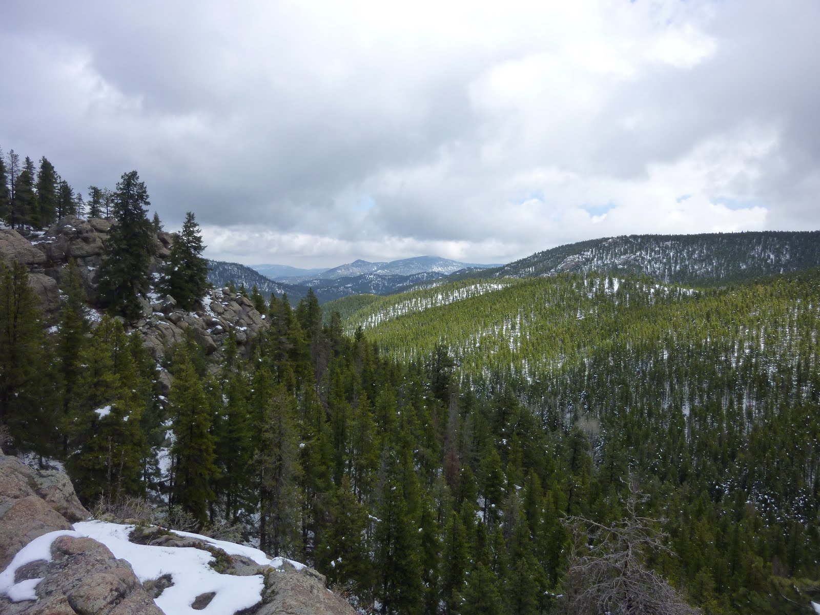
Looking north from the highpoint on the Cliff Trail at Maxwell Falls


Really enjoyed the change of pace this week. Great company. Back to running tomorrow.


Tuesday, May 11, 2010

Elk Meadow - Tempo

Time: 43 minutes
Distance: 6.1 miles
Effort: Hard
Body: Fair
Weather: Socked in and snowing


Got out at the end of the day for a quick tempo workout on the trails of Elk Meadow Open Space.  Ran from home to the upper parking lot as a w/u, then started the tempo run.  Ran the Meadow View - Painter's Pause trails and finished up on the roads back to the house.


I definitely could feel lingering fatigue in the legs from Sunday night's long run.  In fact, at times, I felt for sure like I was running a tempo effort, but far from a tempo pace. Things began to click better the last couple of miles, but I was never close to feeling the groove.


The snow started about one-third of the way through the run.  A neighbor said the weather gurus are calling for "up to" 24 inches up here.  I predict way, way less.  Me...the hopeless optimist.


Sunday, May 9, 2010

Boulder Skyline Traverse - Mesa Return

Time: 5:54
Distance: 27 miles
Effort: Easy
Body: Fair
Weather: Mostly sunny and warm


Eager to up the length and difficultly of my long runs these next few weeks, I decided to kick off the effort with an epic run through the mountain backdrop of Boulder.  


I've read a few reports about the Boulder Skyline Traverse, a route that takes one to the tops of all the city's major summits - South Boulder Peak, Bear Peak, Green Mountain, Flagstaff Mountain and Mt. Sanitas. In total, the traverse is something like 14-16 miles, depending on one's route.  Knowing I wanted a bit more mileage, I decided I'd run the Traverse one way and take the Mesa Trail back.


I set off from the South Mesa Trailhead around 3:30 p.m. The lot was packed and the lower trails were full with people.  From the parking lot, I headed out on the Mesa Trail and quickly hung a left and began the steady climb up the Towhee Trail to Shadow Canyon, bound for South Boulder Peak.  I hit the summit of SoBo in just over 59 minutes and paused for several minutes to take in the view, suck down a gel and chat with a couple of hikers chilling on the summit.  This was my first trip up this mountain. The trail conditions were pretty good with just a few lingering stretches of snow from the top of Shadow to the summit.  No problem navigating around/over them.


I was feeling a bit sluggish on the traverse over to Bear Peak, but was buoyed by views from the rugged summit of this mountain. There were probably 10 people around the summit of Bear. After a brief pause and a minute or two turning circles looking for the entrance to the West Ridge Trail, I was soon dropping steeply down the switchbacks bound for Green Mountain.  After the big drop, I made my way to the Green Bear Trail and took the Green Mountain West Ridge Trail to the summit of Green.  Just a handful of people on this summit, including a couple of young guys that hiked the same route I had just run. I paused again here to enjoy the view, chat a bit and eat another gel.


From the summit of Green, I headed back down the West Ridge Trail to Flagstaff Road. From the top of the road's last switchback, I followed an old, overgrown roadbed down to the Long Trail trailhead and began running down the side of the road toward Flagstaff. I made a couple of detours into the parking areas on the north side of the road to do some exploring...looking for bandit trails that might parallel the road and keep me off the pavement. I ran a couple of old fire roads, but they all petered out and I ended up running a bit on the road.


After a mile or two, I got to the entrance to the Flagstaff picnic/amphitheater area and took the Ute Trail up to the flat "summit" of Flagstaff Mountain. I found the highpoint, climbed up on the rock and set off again munching on a peppermint Luna bar. I ran the Ute Trail to its intersection with the Flagstaff Trail and took Flagstaff down to Halfway House, the first picnic area on Flagstaff Road. From here, it was down the Viewpoint Trail to Eben G. Fine, over Boulder Creek up and over the Red Rocks hump down to the Mt.Sanitas Trailhead.


The climb up Sanitas was a bit slow - roughly 27 minutes, a good nine minutes slower than my PR. I steady-hiked most of it, running the flat sections. This was the only of the five summits that I had to myself.  By this time, I knew I'd be finishing the run in the dark, so I didn't linger on the summit.  I just tagged the summit marker and ate a gel as I began the descent down the east side.


After running down the Sanitas Valley trail, I ran down Fourth Street and over to Sixth Street for the climb up to Chautauqua and the beginning of the Mesa Trail.  By the time I hit Sixth, I was feeling pretty good. I ran a good, steady pace up to the entrance to the Mesa Trail. With daylight fast dissolving, I was eager to get as far as I could on Mesa before true darkness set in.


Well, I made it to the spot just past Bear Canyon where the Mesa Trail again turns to singletrack before it really started feeling dark. The wide, gravel sections of trail were no problem, but the rock and root-strewn sections in the woods were more problematic. Still, I made good progress and other than a few steps in mud, I had little problem with footing.  I never fell, but it I had to go much slower than I wanted to. Yes...next time I bring a headlamp!


All through the Mesa Trail section my legs felt good.  I think I was driven by the looming darkness and the knowledge that JP would be getting anxious about my whereabouts. I think those two factors gave me just enough of an adrenaline boost to push me through those last four miles. A highlight was hearing all the frogs croaking as I approached the pond above Cragmore.  Such a cool sound.


I finally got back to the South Mesa Trailhead at 9:28 p.m. The last 1.5 miles down the Mesa Trail was a joy. It was still warm and I was just cruising down this wide-open flat trail, feeling like I was the only person within miles on that trail (I reckon I probably was).


Total elevation gain - 8,034 feet.


Saturday, May 8, 2010

Elk Meadow Loop+ - Easy

Time: 51 minutes
Distance: 6.1 miles
Effort: Easy
Body: Average
Weather: Mostly cloudy and cool


Easy late afternoon run from home, up the neighborhood gulch and around the Elk Meadow loop and back home via the roads.  Easy run.  Interesting conversation with a mountain biker I passed on the ups and who caught me on the downs. She marveled at my blazing speed, saying "I haven't seen anyone running a pace like that."  I looked down at my watch (which was quite a feat given my speed)...a whopping 7:46 at the time.  Some people, thankfully, are easily impressed.


Friday, May 7, 2010

Flagstaff Mountain - Steady

Time:  1:47
Distance: 10.68
Effort: Moderate
Body: Good
Weather: Mostly cloudy and cool


Evening run from work to the "summit" of Flagstaff.  

Ran up Spruce and Pearl Streets and made my way over to Eben G. Fine park and picked up the trail that takes you up to the first parking area off Flagstaff Road.  From there, I ran the Flagstaff Trail, with its multiple crossings of the road, to the top of Flagstaff Mountain.  

I learned that the summit is not marked, which is understandable since the top is a big flat, open area with a few small rock outcroppings (with a nice view of Green). I cruised around up there a bit and found what appeared to be the highest point, then returned down via the Flatstaff Trail to Crown Rock and then down into Gregory Canyon and finished up the trail portion in Chautauqua.  


Once off the trails, I had a new priority and that was to get as quickly as possible to Illegal Pete's for a burrito.  With burrito in hand, I ran the last mile back to the office and feasted.


A very nice run on some new trails for me.  This was my first trip up to the top of Flagstaff.  Great views down into Boulder Creek Canyon from the north side.


Wednesday, May 5, 2010

Elk Meadow - Meadow View Loop

Time: 42 minutes (too little)
Distance: 5:12 (not enough)
Effort: Easy
Body: Good
Weather: Mostly sunny and warm


Another damn jammed day. Wanted to get out earlier...wanted to get out longer... I shouldn't complain, at least I got out.


Quick loop around the Sleepy S - Meadow View - Painter's Pause loop from home. Definitely was craving another five or so miles. 


Really wondering what the trail conditions will be like for next month's San Juan Solstice 50. Mt.Evans, just west of home base here, is showing no signs of melt-off. I wonder what the conditions are like down around Lake City.  I dropped the RD a note. Will report back on what I hear back.


Tuesday, May 4, 2010

Green Mountain - Ups

Time: 1:07
Distance: 5;12 miles
Effort: Moderate
Body: Average
Weather: Mostly sunny, WINDY


With work consumed by issues surrounding the Deepwater Horizon oil spill, my only hope of getting in a run this day was to hit it early.  So, there I was running up the road to the Gregory Canyon trailhead a bit after 7 a.m. bound for what I knew would be a wind-swept summit of Green Mountain, given the massive gusts that had buffeted my car on the way into Boulder this morning..


I decided to take the Amphi/Saddle/Green route up. I hadn't been up that route since last summer. All was quiet on the wind-sheltered east side of the mountain. However, anytime the trail crested a ridge with any western exposure, I was blasted by the wind. A few times on Saddle, I had to stop and pull down the brim of my hat to hide my face as I was pummeled by sand kicked up by what had to have been 40+ mph winds.  Mother Nature can be a wicked one, sometimes.


Made it to the top of the summit rock in 38:47, knocking 52 seconds off my PR for this route. Didn't linger long due to the howling winds. Returned down via the Ranger/Gregory route.


Monday, May 3, 2010

Flatiron Vista Open Space - Steady Run

Time: 58 minutes
Distance:  7.34 miles
Effort: Moderate
Body: Good
Weather: Mostly sunny, early wind


Post-work run starting at the Flatiron Vista trailhead off Highway 93, en route home from work in Boulder. Started off with gale-force winds howling straight into my face.  The wind was relentless, with gusts that seemingly stopped you in your tracks. I put up with these character-building conditions until I entered the ponderosas on the plateau above the parking area. Once in here, the trees provided some shelter before, miracuously, the wind eased and nearly disappeared. It was that abrupt.  One minute the wind was constant and screaming, the next it was gone. 


With the wind having given up for the day, the fun began on the flat trail in the woods.  After a couple of miles, I dropped west down the ridge on the Dowdy Draw trail and cruised over to the Spring Brook South trail. As I was climbing up Spring Brook, I saw my favorite sight...a mountain biker cranking up the hill about a quarter mile ahead. Ahhhh...something to chase.  I was pressed for time and promised myself I would turn around exactly at 4:35 p.m., no matter what. I caught the rider at one point and asked to pass.  He mumbled something up upping his pace and pushed ahead, staying just out of reach.  I wasn't going all out by any means, just a steady, great-feeling uphill pace. With 30 seconds to go before my hard-stop turn-around time, he surrendered and pulled over.  He gave me a confused look when I appeared 30 seconds later running downhill toward him.  I was smiling...inside.


Retraced my steps back toward the Dowdy Draw/Flatirons Vista trailhead. As I cranked up Dowdy Draw, I caught a runner who turned out to be a Nebraska guy on a recovery run from the Lincoln Half Marathon, where he'd run a 1:12.  We chatted as we ran down the Flatirons Vista North Trail. I bid him farewell as he headed over toward Marshall Mesa and I ran straight to the truck, hopped in and sped home to pick up jP and CP.


Fantastic run. Legs felt great. More importantly, I was totally there mentally...in tune with the trail, feeling the fitness groove and craving more time and more miles.  Amazing what a little sun and shirt-sleeve-only temps can do for a guy.

Average pace: 7:51.  660 feet of elevation gain.


Golden Gate Canyon State Park - Long(ish) Run

Time: 2:36
Distance:  15 miles
Effort: Easy
Body: Average
Weather: Cloudy, snow, cool


First...this looks like fun - a completely unorganized, unplanned throw-down on Boulder's Green Mountain. Be sure to read the rules.

Originally, the plan was to head over to Golden Gate Canyon State Park and run the Dirty Thirty 50K course, but things didn't go as planned.


First mistake was thinking the course map and turn-by-turn instructions were in the back of my car.  They weren't. The second mistake was thinking the trails might be mostly snow-free.  They weren't.  The good news...I went running.


With JP travelling, this was another toll run...the babysitter being the one to whom I had to pay the toll.  So, with no time to waste, I sped the 30 minutes from the house over to the state park visitors center, picked up my $6 day pass and headed over to where the Mountain Lion Trail comes down to the main park road.


From the parking lot, I jumped on Mountain Lion, which snakes up a south-facing slope. The trail here was enticingly snow-free. Everything was perfect as the trail climbed up and over several ridges after crossing over Noll Creek. Soon, though, as the trail dropped back down to the creek and followed it up through a ravine, snow was everywhere.  I did my best to keep running, but between the snow and the snowmelt-swollen stream, I had to speed walk far more than I wanted to.

In the early going on the Mountain Lion Trail. Could it be...snow free trails?

 A bit later on the Mountain Lion Trail, after the trail enters the woods and heads up a ravine.

After crossing the stream seemingly a dozen times, the trail left the creek and climbed steadily and steeply up to Windy Saddle before dropping down to the upper part of Forgotten Valley. Here I left Mountain Lion and started climbing up the Buffalo Trail (ain't it cute how all the trails are named for critters?). Still running intermittently on snow, I made my way up to Rifleman Phillips Campground (how's that for a name?).


Looking back up toward Windy Saddle from the backside, en route down to Forgotten Valley

 The climb up the Buffalo Trail, on what appeared to be an old ranch or logging road.
A lake, with historic cabin on the right in the lower part of Forgotten Valley.

From Rifleman Phillips Campground, I ran Gap Road up to Aspen Meadows Campground where I picked up the Snowshoe Hare Trail and ran by Dude's Fishing Hole. I had to stop several times through this stretch to sniff out the trail.  With all the snow, and the dearth of footprints, route finding was a bit sketchy.  After a bit of trial and error, I was able to follow the trail and climbed up and over a ridge and circled back to Rifleman Phillips Campground.  I retraced my steps down the Buffalo Trail to the lower part of Forgotten Valley.  Finally, I hopped on the southern bit of the Mountain Lion Trail and cruised back to my car.

I think all of the trails I ran, save for the stretch on Gap Road, are part of the Dirty Thirty course. (The race is June 5th.) The running Golden Gate is very nice...some steeps, some rocks, some cruisers, and a fair bit of variation in scenary...open, grassy valleys, thick lodgepole forests, rugged mountains and numerous creeks, especially this time of year.  And, the area is peppered with log cabin ruins and a lot of pioneer history.

I was disappointed not to have gotten in more miles. The snow definitely slowed me down, and dampened my desire to keep pressing. And, the clock was ticking and needed to get back home to jP and CP.  Still, it was good to run somewhere new (I hadn't been in the northeast part of the park before), even with the poor conditions.

And, I can't leave without, once again, lamenting the long march of winter. Bring on the warmth and sun!


Saturday, May 1, 2010

Elk Meadow Super Loop - Easy(ish)

Time: 1:23
Distance: 10.19 miles
Effort: Easy (mostly)
Body: Good
Weather: Partly Cloudy & Cool


Colorado's Tony Krupicka wins Miwok by about 18 minutes over Hal Koerner!  See the Twitter stream, including pics and video here.  Check out the pic of his feet. Running can be tough stuff...


And a huge congrats to Jim M. who came in 6th in the Greenland 50K today.  Way to go!

As for me...twas a late morning loop using most of the lower trails at Elk Meadow Open Space. I was eager to get in a few miles on this, the last day of the week, since I missed a couple of running days this week due to work and travel.

Felt pretty good on these miles, running steady. Most importantly, though, is the fact that there was not a snow-covered stretch of trail in all 10 of these miles.  Whetted my appetite for more of the same. 

1,178 feet of elevation gain.


Trying to figure out where to do the long run tomorrow...