Showing posts with label Mt. Falcon. Show all posts

Thursday, May 31, 2012

The Fortnight That Was - 5/13 - 5/26/2012 and the Hardest Run Ever

(Started this post days ago...finally getting around to posting it.) Two weeks of running, both literally and figuratively...some mountains, some beaches and some not at all.


All-in-all, it's been a good couple of weeks. I missed a few days here and there, but have managed to get in some good runs between the chaos that is our lives.

Week 5/13-5/19 - the highlights:

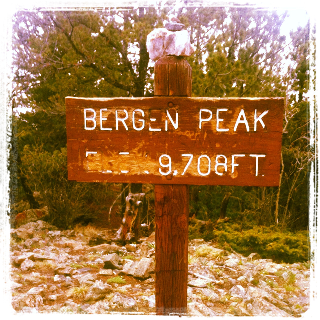
Sunday - Bergen Peak - 15 miles; 2:45; 2,783 feet o' elevation gain: Ran from home to the summit of Bergen Peak, then dropped off the backside into the Bergen Peak State Wildlife Management Area tract and found a great trail that descends down into the Echo Hills subdivision. Did some exploring trying to find a new way into the adjacent Denver Mountain Park tracts that lay between the subdivision and Squaw Pass Road. Ended up traipsing through some private property and then bushwhacking down a ridiculously steep and thickly-wooded hillside before finding a fire road on a DMP tract. Added some miles via the roads in Soda Creek.


Tuesday - Marshall Mesa - 16 miles; 2:15; 969 feet o' elevation gain:  Early morning spin around the    Dirty Bismark loop. Beautiful morning on these wide-open trails. Saw and heard WAY more meadowlarks than I saw people.

Thursday - Colorado Trail - 8 miles; 1:25; 1,271 feet o' elevation gain:  CP was doing a class camping trip on some private land just below Kenosha Pass. We were jumping on a red-eye later this evening bound for Florida, so I headed over in the early evening to the campsite to pick her up.  Along the way, I stopped at the parking area on the south side of Kenosha Pass for a quick out-and-back on the Colorado Trail. Legs were flat and not happy with the run, but the scenery more than made up for it. Turns out, the property where the kids were camping was about half a mile below the spot where this picture was taken. You had to cross the CO Trail on a two-track to get to the spot. Such a cool location!

The Colorado Trail below Kenosha Pass.
Week 5/20-5/16 - the highlights:

Sunday:  Palm Beach - 16.68 miles; 2:23 - We flew all morning on Friday (1 a.m. - 6:30 a.m.) to Ft. Lauderdale on Spirit Airlines so we could join family in marking JP's grandmother's 95th birthday party. Spirit Airlines managed to lose my luggage, which didn't arrive in Florida until Saturday at 3 p.m.  So, Friday and Saturday were forced days off.  With running gear now in hand, I got up early Sunday for a jaunt around the tony enclave of Palm Beach. I started at our Fairfield Inn hotel located on Palm Beach just over the Intercoastal Waterway from Lake Worth and headed north. Most of the main road along the beach from our hotel to the Breakers Hotel was closed due to sewer replacement, which meant I had long stretches of beach-side pavement all to myself...well, just me and several hundred very, very expensive houses. Ran to downtown Palm Beach, over the Intercoastal to West Palm Beach, turned around and ran back. Got pretty darn hot and humid over the last 4-5 miles.

Palm Beach sunrise.

An aptly named road in West Palm Beach
Thursday:  Mt. Falcon Open Space - 13 miles; 2:06; 2,656 feet o' elevation gain:  Way early morning run with Joe Z. and Woody A. around this open space park in Morrison. Solid effort throughout the run, including 3+ miles of quality downhill to finish things off. We were done by 7:15 a.m. By 3 p.m., I was ready for a nap. That 4:15 a.m. wake-up hurt.

Saturday: Mt. Evans Wilderness Area - 28 (ish) miles; 9:15; 7K(ish) feet o' elevation gain:  This was a brutal run, done with Joe Z., Todd G. and Troy H. The first 14 miles from Echo Lake on the Captain Mountain Trail and the Lost Creek Trail were great. However, once we got onto the Cub Creek Trail, things turned ugly fast.

Joe Z. cruising down the Captain Mountain Trail in the early morning light.
Just a little ways up the Cub Creek Trail we hit a bunch of downed trees. No problem. Downed trees in the spring are part of trail running.  The winter always brings down a few big ones.

Just a few trees on the climb up the Cub Creek Trail...no problem.
The day's plan, for me, was to be out for 4-5 hours.  We ended up being out for 9:15. We spent a good four hours climbing over, under and through a massive evergreen blowdown. Turns out there must have been one hell of a windstorm/microburst on the east side of Mt. Evans this winter. The scale of the destruction was pretty incredible. And, the result is virtually impenetrable. Down trees were 4-10 feet high, covering the trail and making movement painfully slow. The only time we got 4-5 consistent steps was when we were walking on a down tree trunk five feet from the ground. It's amazing we got out of that mess without any injuries worse than our shredded legs.

Todd G. surveying the damage.  
The power of the wind had to have been tremendous.
Note:  Despite using terms like "massive" and "scale of destruction," let me be more direct. Do NOT venture into the Cub Creek Trail area.  It's simply not worth it.  This is not a log-hopping problem. This is crawling and climbing through branches, over big, full, downed trees and dealing with extreme route-finding. You can't follow the trails. We ended up just bushwhacking from one drainage to another trying to make our way over to an old burned area to the north, which we knew was where the trail back to Echo Lake ran. This was a TOUGH day.

After bushwhacking and emerging into a nice, trail-less meadow, Todd, Troy and Joe try and figure out where we are.
"I think we're in this drainage. Now, if we just climb over this ridge..."
Of course we eventually made our way out of the blowdown and back to the cars. Everyone was quick to check in with families to let them know we were safe.

Post-run. Ouch. Let the healing begin.
Toward the end of the "run," I definitely was having those "why the hell am I doing this?" thoughts.  When I got home, I told JP I needed to give some serious thought to whether the time/training was worth it.  A day later, of course, those thoughts are long gone and the desire to run is right back where it should be, for now.

The banishment of the negative thoughts was hastened by a really fun five-mile hike the next day up Chief Mountain with CP and our two dogs, Cisco and Maya.

CP on the summit of Chief Mountain. 
Bristlecone snag on  Chief Mountain.
Nothing like sharing the trails with an 11-year-old to bring some perspective.  Onwards!!


Thursday, December 22, 2011

The Week That Was...December 12-18, 2011

Way delayed in posting this incredibly important data. Not an impressive week. Took a biz trip to D.C. Didn't run for three days in order to clear the system before a blood test.


Monday - Upper Bear Creek Road - 9.4 miles; 1:15 - Tempo run. Ran from the lake house with Steve F. for a couple miles before letting him dash on ahead. My legs were floundering due to the 17-mile tempo(is) run the evening prior. Got about 4.5 miles up the road when I met up again with Steve. Turned around and ran three miles of tempo with (OK, a few feet behind) him. Legs protested a lot, but held pace (6:18; 6:14; 6:08). Interesting experiment to run hard on such tired legs. Felt good (mentally).


Tuesday - Off - Travel to D.C.


Wednesday - Off - D.C. Needed to take two days off in prep for a blood test related to last summer's brachial plexus neuropathy.

Thursday - Off - Traveled home.


Friday - Hiwan Roads - 5:13; 43:24; 524 feet o' elevation gain. Easy run through one of the local subdivisions.  Got the blood test in the a.m.  Results at January doc appointment.


Saturday -  Mt. Falcon Open Space - 16 miles; 2:56; 3,122 feet o' elevation gain.  Hooked up with Woody A. for a 6 a.m. start. Plan was to run the v1 route (Woody was planning to double it.)  We ran steady the whole time on snow-packed trails. Conditions were very good, with just a bit of ice here and there.  We doubled the Ute Trail figure eight in hopes of finding Jaime Y. who was planning on running the same route, but started an hour later. We never came across him. I was pretty pooped by the time we got back to the lower lot. Watched with great respect as Woody set off again for the long climb back up to the picnic shelter.  Went home and took a nap.


Sunday - Elk Meadow Open Space - 5.71 miles; 51:17; 844 feet o' elevation gain. Ran the Meadow View+ route from home. Easy.

Overall, a rather unimpressive week. That said, the Monday Upper Bear tempo w/ Steve was a lot of fun.  And, the Saturday Mt. Falcon expedition with Woody was challenging and satisfying.

Wednesday, August 31, 2011

Mt. Falcon - Ups

Solid run up the big climb from the lower lot, then sort of dragged myself around a big loop up top.

Time: 1:45
Distance: 10.3 miles
Body: Good
Effort: Hard
Weather: Warm and sunny

Heading over to Mt. Falcon in Morrison from an appointment in Englewood, I had that feeling indicating a good run was in the cards.

After lacing up the shoes, and setting off up the Castle Trail, it was confirmed...I was feeling pretty good. I hung a right on the Turkey Trot Trail and wound my way up through the early steep stuff. Still feeling good. I cruised up Turkey Trot to the intersection with the Castle Trail. Hit a split here - 19:20. Maybe I could PR the climb from the lower lot to the picnic structure.

I was focused on quick turn-over and a short stride, whizzing right by a half-dozen mountain bikers on the way up. Ran hard up the last switchback to the picnic shelter and looked down at the watch - 32:32. Not a PR.  I was 1:13 off of my best, which is 31:19, set a while back when I was chasing Scott Jaime up that climb. Still, given the last couple of months of modest-at-best running, I was happy to feel good up that long (actually, just three miles - and 1,400 o' elevation gain) climb.

From the picnic shelter, I ran a bit more up the Castle Trail, took a left on the Meadow Trail and ran a big loop via the Parmalee and Castle Trails (counter-clockwise).  I definitely mis-judged the length of the Parmalee Trail and ended up being out there far longer than planned. The last 1.5 miles (or so) down Turkey Trot were tough (and slow) in the fading light, especially since I was still wearing prescription sunglasses.

I'm still shooting for a sub-30 to the picnic shelter. I'm going to get that by the time the snow flies.

2,172 feet o' elevation gain.


Monday, April 4, 2011

One Step Forward...One Step Back

A couple runs, some treatment, a fall and a couple more days off.  In other words, more of the same.


Eager to get back to regular, pain-free running, I made an appointment  Thursday with a local chiropractor/massage therapist that a woman at a local health club highly recommended (and who had her office inside the club).   

Just prior to the Friday appointment, I dashed out for a quick run around the Meadow View Loop at Elk Meadow Open Space.  With Maya on a leash, we ran the 5.63 mile loop in 47 minutes (658 feet o' elevation gain).

A few minutes later, I was showered and sitting on a massage table explaining the bedeviling collection of aches that had enveloped pretty much the entirety of my left mid-section. 

Over the next 45 minutes, she poked, prodded and pressed her way into discovering which of my muscles were the offenders causing my 2+ weeks of crappy running.  During this time, she used a combination of Active Release Therapy, massage, cold laser treatments (supposed to reduce inflammation) and adjustments (hips) to try to realign my then-misaligned pelvis and sooth my inflamed muscles (muscles with names like gluteus medius, periformis and others I can't begin to remember).


When I stood up at the end of the session, I was still sore, but felt better for the work.  I finished the day with a long course of stretching and ice.

Next up was an early Saturday morning rendez-vous with Woody and Joe Z. at Mt. Falcon for a go at the v1 (version one) route, which is essentially running every trail in the park starting from the lower lot.

Just past the prescribed hour of 5:30 a.m., with headlamps illuminating the trail in front of us, Joe, Woody and I set out up the Turkey Trot trail.  The first steps felt good, a definite improvement.  I remember thinking I was on the mend and pain-free running was just around the corner.  All good…until it wasn’t.

After about a minute of running, I decided to take the headlamp off my head and carry it instead.  In the 10 seconds it took to move the light, I managed to catch my left toe on a nice, big rock, which sent me lunging forward into the darkness.

Before I knew it, I was flat on my back, head facing downhill, taking stock of the damage. Naturally, all the torque from the fall was centered on my left side.  And, of course, I fell on my left hip.  Yep, in a split second, I undid all the good the chiro had done in 45 minutes the day before…and made things worse.

Un-fu*&#ing-believable!

Well, no point in wallowing in self pity when a beautiful sunrise and 14 miles of excellent trail lay ahead.  The only catch was I had to get my ass up off the ground before I could start running.

With a couple of grunts, a couple dozen yards of walking to shake off the effects of the impact, we were off, chugging up the early steeps on Turkey Trot.

After a lot of early lingering hurt from the fall, I settled into a manageable level of discomfort and stumbled up to the picnic shelter in 36:18 (including time spent laying on the ground). 

After re-grouping, we ran the rest of the v1 route, pausing at major junctions to stretch and take stock.  Pain-wise, things were manageable, but stopping was not a good thing. Stiffness would set in almost immediately.  Over the course of the run, descending became the hardest part.

By the time we returned to the picnic shelter for the final descent back to the parking lot, I was resigned to watch Woody and Joe disappear before we even got to the second bend in the trail.  I brought up the rear, running down the steady downhill at a sorry 8:50 pace.

Shortly after turning left to finish up the descent down the Turkey Trot Trail, I passed Tim L. and Jeff, who were headed up.  We all paused to exchange greetings.  Tim asked if I was running with the two guys ahead, I sheepishly admitted I was, fighting hard not to offer unnecessary explanations about why I wasn’t actually running with them.  (Jeff – good to meet you at long last!) After a couple of minutes, I continued on and found Woody and Joe soaking up the view of Denver and beyond from a grassy vantage point.

We wrapped up the run together after disdainfully pointing out the rock that grabbed my toe two hours and 35 minutes and 14.23 miles prior. (2,897 feet o' elevation gain).

The rest of the day was a rough one.  If I owned crutches, I would have used them.  Man, was I sore.  I walked a couple of miles after I got home and later that evening to keep the circulation moving and spent the intervening time laying around reading and playing games with the kids.

Woke up Sunday morning still hurtin’ somethin’ fierce.  Day off.

Got out of bed this morning in a bit better shape.  Went back to the same chiro/massage therapist late morning for a repeat session.  The knots from Friday were mostly still gone, but new inflammation from the fall was obvious.  So, more prodding, cold laser treatments and a hip adjustment were on tap.  Taking the day off and focusing on ice and stretching to see how things go.  Plan to visit the chiro again on Wednesday.
Saturday, January 29, 2011

Mt. Falcon - v1

Early morning group run around the full complement of trails in JeffCo's Mt. Falcon Open Space park.


Time: 2:26
Distance: 14 miles
Effort: Moderate
Body: Fair
Weather: Brilliant

Rolled into the Mt. Falcon parking lot at 7:02 a.m. and found motley group of runners standing around...waiting. Glad the the Two Minute Rule wasn't in effect, or I would have been running alone most of the morning.

The group, which consisted of me, TG, PG, JY WA and BF started out together, but soon spread out as the Turkey Trot Trail turned upwards. Mt. Falcon starts in a pretty unforgiving fashion, with the steepest climbs in the park appearing within the first three minutes of starting out.

The plan for the day was to run a route known as v1 (version one). Not sure why it's called that, but it works. This was my second time running this route. The first was a humbling experience back in October with Scott J.

We quickly spread out as we each found our warm-up paces. We climbed steadily up to the picnic shelter with TG and BF setting a solid pace. I hit the shelter in 34:30.  I was not feeling it...no pep this morning.

After regrouping, we made quick work of a couple short out-and-backs on the left and right side of the trail before climbing up to near the park's apex and running a series of looping trails to the south and east.

I never found my legs this morning. I think I may have left them on Green Mountain yesterday. Felt this morning like I was suffering pretty much the whole time, save for the final 2.5 mile descent down the Castle Trail.

Beautiful morning with the warm temps. Trail conditions were fair. There was quite a bit of ice on the upper portions of Turkey Trot and on the loop trails towards the east. Still, a great run with a solid group of friends.

Even though I felt sluggish today, I had the most solid week of running since October. The left heel is definitely feeling better, making running much more appealing (and possible). For the last three nights, I've worn a night splint. That seems to be making a significant difference.

Also, on Friday morning I had my first-ever acupuncture treatment. The therapist did a whole mess o' needle insertions in areas on my left calf, aimed at getting all the stuff that's tight in there to let go. The calf muscles seem to be pulling on the heel, leading to all the pain I've been having there. She also did a bunch of work on my right ab to see about easing the muscle tear/discomfort that's been plaguing me in that area. I ended up with a lot of new soreness in my calf, which she told me to expect (and which eased a lot overnight). Not sure yet if it's helping the heel pain or not. I'm going to go back another time or two to let it play out. I'm really keen to get past this seemingly chronic injury. Would be very nice to run pain free. Starting to see some daylight now.

2,878 feet of elevation gain.

Thursday, October 28, 2010

Mt. Falcon - Everything

Long,hard morning run touching almost every bit of trail in Jefferson County's Mt. Falcon Open Space near Morrison.


Time: 2:08:44
Distance: 14.26
Effort: Hard
Body: Fair
Weather: Sunny and cool

When I look at a GPS rendering of most of my runs I either see symmetry, as in when I run a nice long loop, or the simple, thick, squigly line of an out-and-back. Today's run provided neither familiar pattern.

Today's GPS rendering of a run in Mt. Falcon Open Space park looked more like something one would get by radio-collaring an inebriated bear and turning him loose in the foothills..

The route Scott J. and I ran today, which Scott calls "Version One," takes one to nearly every trail in the park, save for a brief equestrian bypass up top and the lower portion of the Castle Trail, which descends down the frontside of the park and is the alternative to the hiker-only Turkey Trot Trail (a more scenic and singletrack ascent/descent).

After a quick greeting in the chilly winds buffeting the lower parking lot, we set out at a steady climbing pace up through the early steeps and then onto the more gentle grades of the Turkey Trot Trail. We then merged onto the Castle Trail and climbed to the picnic shelter and hit a split of 31:19 (a PR for me by a couple of minutes...but only the third time I've run up that route).

From there, we ran up a couple of dead-end ascents (with views) before getting back on the Castle Trail and running it to it's high point. Next up were a series of loops on the Parmalee, Old Ute and Devils Elbow Trails before returning to the Castle Trail for the descent.

I was dragging on the last few ascents, feeling like I'd pretty much out-run the calories provided by the homemade fruit/greens/protein smoothie I'd had for breakfast. I was ready for some gravity-assist by the time we hit the picnic shelter and began cruising back down to the lower parking lot.

All-in-all, a good, tough run on a beautiful Thursday morning. The wind was all but gone by the time we got back to our cars.

2,903 feet of elevation gain.

Saturday, October 16, 2010

Mt. Falcon Open Space - Solid

A pressed, but solid early morning run complete with mucho climbing, a sunrise and remnant fall colors.


Time: 1:46
Distance: 12 miles
Effort: Moderate
Body: Good
Weather: Sunny and Cool

Met up with Scott J. and Patrick G. at dark o'clock in the chilled lower parking lot at Mt. Falcon Open Space. Given the early morning wind and darkness, I figured both guys were cursing my out-of-nowhere request that they reschedule their planned 7 a.m. run for 6:30 a.m. (Thanks, guys.)

Things warmed up almost immediately as we started the the steepest climb of the day, which is the early section of the Turkey Trot trail. We climbed steadily, hitting the picnic shelter in something like 33:50 (my watch battery was dead). From there, we climbed up a couple of dead-end trails to pick up some additional vert, then ran up to just below the upper lot.  Here, we hung a left and ran the Parmalee trail.  Due to a day-long Mountain Area Land Trust board retreat, I had to split, leaving Scott and Patrick who still hand another 2.5 hours of running planned.

As I ran hard back down the frontside trails, I was constantly looking at my watch doing the usual mental calculations trying to figure out if I could make it to the retreat on time, given I still had to get home and shower.

I mis-calculated by about three minutes, but at least I showed up in clean clothes and sweet smelling.

Great way to start the day.


The one hang-up, though, is that yesterday I caught the second toe on my right foot on a trampoline net. Hurt like heck. Post-run, the toe was reallyˆhurting and it's now swollen and an ugly shade of purple. Wonder if I broke it...  Damn.

Sunday, May 30, 2010

Mt. Falcon - Recovery (?) Run

Time: 1:35
Distance: 10.26 miles
Effort: Moderate
Body: Fair
Weather: Clear and Cool


For the last month or two, Todd G. and I have been exchanging e-mails trying to figure out a time when work, family and life schedules would allow us to connect for a run. Finally, this morning the stars (and schedules) aligned and we met up at 6:30 a.m. at the base of Mt. Falcon.


I've been eager to run with Todd, not just to connect with a new running partner, but to pick his brain on Lake City, which he's run (and run well) twice. After a quick introduction at the trailhead, we set off up the Turkey Trot Trail with Todd setting a solid pace. My legs were feeling yesterday's 24 miles and 7,600-feet of elevation gain, but things got better after the initial steep sections were behind us.


As we ran, I tossed out a few questions between gasps, Todd shared his running experience and somehow we made good time up the frontside of Mt. Falcon via Turkey Trot and the Castle Trail (hitting the picnic shelter in 34:27) and continuing on to the upper intersection with the Parmalee Trail. We descended down Parmalee and looped back up to its lower junction with the the Castle Trail.  


The front side of Mt. Falcon from near the parking lot. The Turkey Trot Trail is in the foreground.


I had limited time this morning, so we returned down the way we came, keeping up a running dialog the whole way. As I headed for the car, Todd headed back up Turkey Trot for another ascent up the front side of the hill, no doubt getting in a few miles preparing to defend his title next weekend at the Golden Gate Dirty Thirty 50K.


That's Todd in white headed back up Turkey Trot in the center-right of the pic.

It felt good running on tired legs on such a brilliant morning...blue sky, cool temps, empty parking lot and good-natured hikers and bikers sharing the trail. A perfect Sunday morning.

Total elevation gain:  2,177 feet.

Monday, April 12, 2010

Mt. Falcon , Red Rocks, Hogback - Long Run

Time: 3:25
Distance: 20.52 miles
Effort: Easy
Body: Average
Weather: Sunny & warm


If you had to pay to run, would you? I would, and today I did.


With JP travelling for work this weekend, my options were to take the weekend off, or find a babysitter to watch JP and CP while I got in a long run. The Babysitter Gods were smiling this weekend, and I was able to get out for a reasonably long run this morning under sunny skies and 70+ degree temps. It cost me a few bucks, but it was money well spent!  And, I got out early enough to still have the afternoon to goof around with JP and CP.


Due to time considerations and lingering snow in the higher elevations, I opted for some Front Range trails. I started just outside of Morrison by C-470 and began running west toward town.  I remembered a trail I had seen last summer on the southeast side of the hogback. I found it again, complete with a sign that helpfully read "Trail."


The trail was actually a set of stairs heading steeply up. Assuming the trail would take me up to a trail along the top of the Hogback, I headed up. The trail, instead, dead-ended at some climbing spots. Figuring there had to be a trail up top, I did some class II climbing to get up and around some big slabs and made my way to the top of the hogback. Alas, no trail. Despite having thoughts of "when you're in a hole, stop digging" running through my mind, I pressed on. Surely there must be a trail somewhere. Public land this close to the Metro area is too precious. Alas, twas not to be. After scrambling for 25 minutes (the first mile clocked in at 26 minutes), I decided to cut my losses and started down-climbing the west side. My destination was Mt. Falcon Open Space, which I could see from my now-lofty vantage point. The challenge was that there's a quarter-mile of private land between the public land and the road I needed to be on. So, I ran south, figuring I could find a sneak to get to the road. After a couple of miles of running along old cow tracks, I hit a dirt service road and made my way out. I never jumped a fence, but the gate I had to hop to get to a public dirt road indicated I was traipsing across someone's ranch, at least for a bit of the way.


The hogback outside Morrison from Mt. Falcon Open Space. I climbed up the left side.


Well, now I know...there's no trails along that section of the hogback.  So, onto Mt. Falcon.


I ran a steady pace up 3.8 miles up the mountain on the Castle Trail, hitting the shelter in 30 minutes and the upper parking lot in 43 minutes. On the upper reaches of the trail, I ran into Donnie, a guy I ran with for several miles at the Moab 50K. He was out getting in some miles in preparation for the Collegiate Peaks 50 and the SJ50. He was running with another guy out prepping for Western States.


Looking west on the upper section of the Castle Trail in Mt. Falcon Open Space


After turning around and heading back down, I made my way over to Red Rocks and ran a series of trails through the big red rocks to the amphitheater. The joint was hopping, with many people out sightseeing, exercising and taking in the views. I ran up the stairs to the top and continued on running a series of roads and trails, making my way over again to the the hogback, this time several miles north of where I started. 


Red Rocks Amphitheater 


I picked up a trail across from Red Rocks, climbed to the top of the hogback (there is a trail along this section!) and then down to Alameda Parkway, which is now closed to cars west of C-470. Now on pavement, I pushed the pace a bit at the end to polish off the last two miles (7:25; 6:52).


3,813 feet of total elevation gain for the day..


Monday, November 9, 2009

Sunday, November 8 - Tour de Bear Canyon Parks

Run: Mt. Falcon - Lair O' the Bear Loop
Time: 3:04
Distance: 19.31 miles
Effort: Easy
Body: Good
Weather: Cool and clear

Started thinking early Sunday morning about where to run today. I had some ideas about what I was looking for...I wanted to run long...wanted to run as much as possible on snow-free trails...wanted to hit something new. After a bit of back-and-forth, I decided on a loop I'd been thinking about doing for a couple of years, but had never gotten around to - a loop run through a series of Jefferson County Open Space parks and Denver Mountain Parks, beginning and ending in Morrison -- the Tour de Bear Canyon Parks.

Before heading out to run some errands with JP and the kids, I jumped on Map my Run to see if I could get a fair guesstimate about mileage (Map My Run doesn't show trails). After a bit of tinkering, I came up with a guess of 16-20 miles. Perfect.

I parked my car in downtown Morrison around 2:45 p.m. and headed out uphill on Highway 8 south and made quick work of the 1.5 miles or so to the Mt. Falcon Open Space parking lot. I jumped on the Castle Trail and climbed about four miles and 2,000 feet to the upper parking lot. From here is was downhill on a series of paved and dirt roads to the small community of Indian Hills. I ran through town on Parmalee Gulch/Meyers Gulch Road, past Pence Park, a 320-acre Denver Mountain Park acquired by the city in 1914.

Directly across from Pence Park, I hopped on the Bear Creek Trail (BCT), a five-mile or so undulating singletrack trail though a gorgeous collection of ponderosa pine forests and meadows. The BCT runs through O'Fallon and Corwina Parks (two more Denver Mountain Parks, acquired in 1938 and 1916 respectively) before dropping down to Bear Creek Canyon and JeffCo's Lair o' the Bear Open Space. (Trail map of the area here.) Here, the trail runs along Bear Creek for three miles or so, including a stretch across from the surprising Dunafon Castle, a residential property used for weddings and such.

By the time I hit the main Lair o' the Bear parking lot, it was pretty much dark. I continued along the BCT until it dumped out into yet another Denver Mountain Park. This time, it was the 400-acre Little Park, acquired in 1914, and located near the Bear Creek Canyon community of Idledale. From here, it was pavement time.

As it was now dark, I once again had to question my thinking...wearing all black while running in the dark down a winding, two-lane canyon road, just like last weekend. I gotta start planning better.

Feeling a bit anxious about the darkness, I picked up the pace (last three miles were 7:28, 7:08 and 7:03) and made relatively quick work of the four miles from Little Park back down to Morrison. There was a decent shoulder most of the way, but enough of a squeeze to keep me constantly looking over my shoulder for cars racing down the canyon. Incidentally, the stretch of Bear Creek Canyon Road (Highway 74) from Little Park to Morrison is actually yet another Denver Mountain Park, acquired in 1928. It's called Bear Creek Canyon Park and is comprised of a 400-foot strip of land (130 acres) that follows the road.

So, for the day that was seven parks, 19.38 miles, 3,411 feet of elevation gain, three gels, two bottles of water and one great work out.